Tourism in Kenya has taken a beating over the last few years, so the Kenya Tourism Board has launched several #TembeaKenya (i.e. visit Kenya) campaigns to promote domestic tourism.
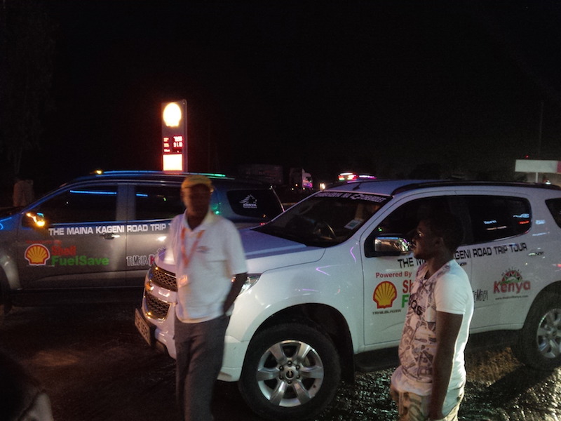
Last Friday, saw the start of the Malindi leg of the Magical Kenya Maina Kageni Road Trip Tour, which is one of the promotions to highlight local tourist attractions. Through this one, the popular radio host has visited several counties in a caravan of Chevrolet TrailBlazer vehicles provided by General Motors – East Africa (GMEA) and fueled by Shell fuel (Vivo Energy).
Emali stop over
The drive to Malindi (and Watamu) started at the GM Nairobi office at about 4 a.m. and the fleet of Chevrolet SUV’s took off on the dark highway towards Mombasa. The early start was to avoid the heavy traffic along the highway, and we met the first signs of that a half-hour later at the Machakos turnoff which was full of trucks parked on both sides of the highway. The first stop was at a petrol station in Emali town at 530 a.m. for refreshments.
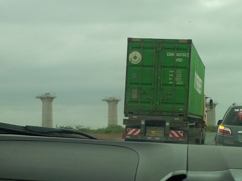
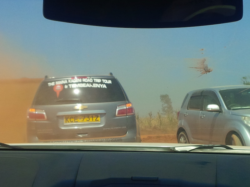
Soon after, as the sun rose, we had the first view of the construction of the standard gauge railway (SGR). However, on the road trip, you don’t see as much of the new railway as you do when you are on the RVR Mombasa train. But we still saw two trains on the new railway, with another near Voi town where the highway is adjacent to the new highway for several kilometers.
Overtaking trucks near SGR at Voi
We stopped in Mbuinzau for some drone shots and to wait for some late-starting vehicles. This part of the country was very green with fields of banana and maize on different sides of dry river beds. The many small towns we passed through had empty stalls which would likely be busier later with sellers and buyers on the roadside.
We stopped at Mtito Andei for almost two hours. This is the traditional mid-point stop between Nairobi and Mombasa, and also the turn-off point for many visitors who would then proceed to either Tsavo East or Tsavo West national parks which have many lodges like Kilaguni, Ngulia, Voyager, Finch Hattons and Severin.
We then continued at a rapid pace, overtaking lots of trucks that sped on the highway in the daytime as well as late night and the caravan made good time at speeds of about 120 kilometers an hour.
There are few road signs on the highway to know which town you’re passing, and sometimes they’re confusing e.g in Mackinnon town, where there’s a bridge being built for the new railway to pass over the road, there’s a sign that says “86 kilometers to Mombasa” next to another one that says “96 kilometers to Mombasa”. This also used to be the first point where you’d spot a coconut tree, but it seems coconut trees are now being grown further away from the coast, to the north-west around Lake Victoria and even near Mount Kenya, where you can find a coconut farm in Meru.
It’s now much warmer here and the roadside was dotted with local produce like paw paws, charcoal sacks of charcoal, and sisal.
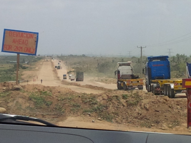
Taru diversion
After that, we passed the first stretch of bad road after Mackinnon. This is the road under construction with two diversions on both sides of Taru, a mushrooming town with lots of buildings right next to the road. The road is narrow, with bumps, many trucks to overtake as well as impatient drivers. There should be ample space for traffic to pass on the highway, but if there’s any blockage, or it rains, or drivers overlap, then the highway can still easily get blocked.
This happened in October and November last year, and local leaders expressed concern when there were highway delays of several hours that inconvenienced motorists, food supplies and tourist movements.
Hersi FB map bypass to North Coast
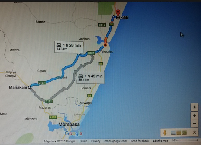
The delays at places like Taru, Mariakani and Likoni got so bad in December, ahead of the busy tourism season, that Mohammed Hersi, who’s the chairman of the Kenya Coast Tourism Association and a veteran hotelier (unofficial ambassador for Mombasa tourism) posted several maps on Facebook of alternate routes that tourists could use to access parts of the South and North coast and avoid these choke points.
We took one of these, turning off at Mariakani about 35 kilometers from Mombasa to proceed toward Kilifi. There’s poor signage marking the turnoff, and we asked for directions and were told to use the bypass and avoid the main highway which had much more traffic, even now.
Kilifi bypass
The bypass was very smooth, and we made good time on it. It has no lane marking, no signs or bumps, and there kids running next to the road which had many fast stretches.
It went very well but for the last 12 kilometers to the Takaungu turnoff on the Kilifi highway, which have not been tarmacked. The rough road stretch was okay for the cars, and there was no need to deploy Chevrolet four-wheel drive, but that will probably be a necessity in a few month’s time when the long rains start, and also on the main highway around Taru unless the contractor is able to complete his work.
The driver of one Chevrolet TrailBlazer who had earlier made two side-trips around Mtito was a bit worried about his remaining fuel, but the car computer calculated that, even though the fuel light was now on, the car could still do another 80 kilometers and he was able to arrive in Malindi without making a fuel stop.
We had started at Nairobi at almost 4 a.m. and got to Malindi at 3:30 PM, completing the 570-kilometer journey in about 9 hours (after excluding the 2 hours of stops).
Wonder if the GoK gives or is willing to subsidize any other form of transport other than chatter flights, or another tourism sub-sector, to encourage tourism for locals and internationals.
That’s not easy to do, but off-season rates can be up to 50% off for local tourists at hotels from what was charged in the high-season (i.e. December)